UNDERSTAND CHANGE THROUGH TIME
Land Scanner enables understanding of land-use changes, flooding frequency, forest changes, bare soil and harvest cycles through time. Using consistent satellite data dating back to 2017, it can easily monitor environmental changes over time.
Align landscape risks with other data
Land Scanner is a spatial tool and enables multiple timeframe data to be assessed against existing data. This enhances landscape understanding, priority areas and impacts.
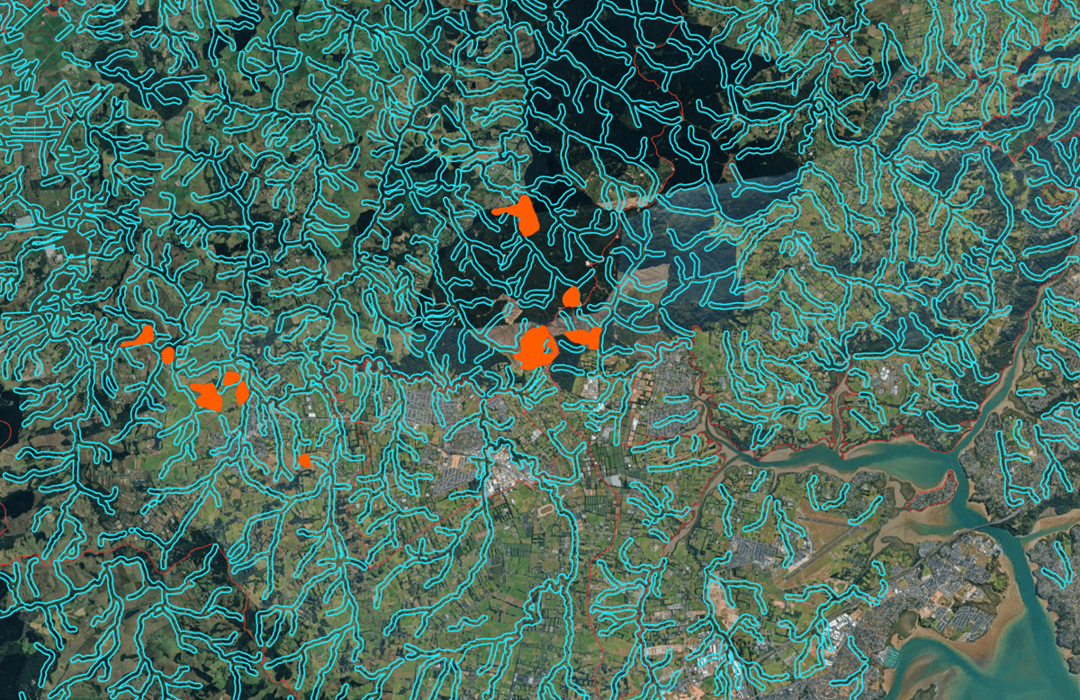
Map: Erosion / bare soil areas overlaid with stream network. Light blue outlines all rivers with a 50 m buffer zone. Orange areas are the bare soil areas that intersect with those water ways.
Long-term risks
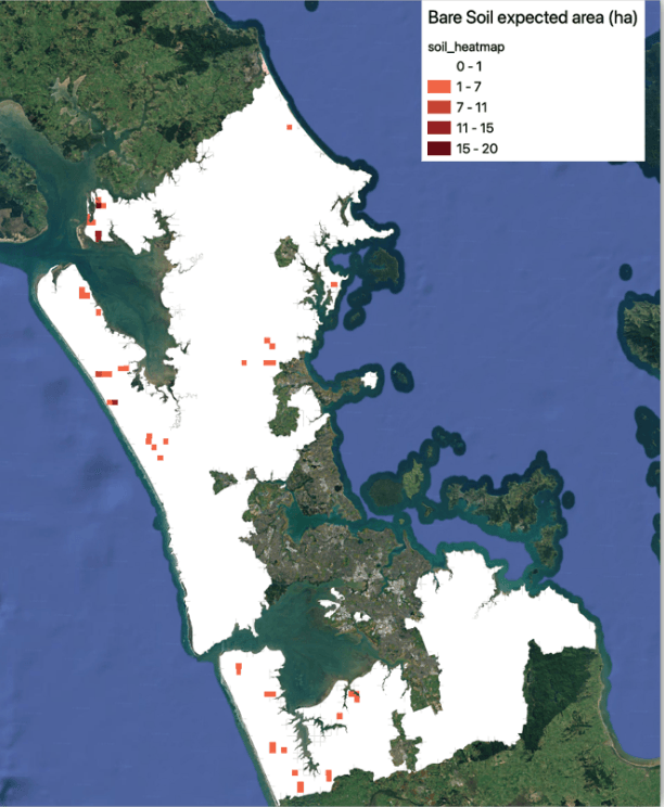
Land Scanner tracks changes in bare soil over time and area, helping users see long-term risks and patterns of soil exposure. Understanding bare land across the landscape enables understanding of cropping cycles, periods of risk, erosion scar development and erosion scar recovery. This can help understand farming systems and specific applications.
Regional vulnerabilities
Understand regional vulnerabilities by using Land Scanner to forecast landscape changes, including transformations like bare soil. It can understand certain land at risk to erosion and measure the response of the landscape after extreme weather events.

Develop community plans
Land Scanner data assists communities with developing evidence-based plans through the region which matches their landscape characteristics. This allows prioritization and resourcing based on evidence.